Issue
A nonprofit partnership is working to preserve and restore the natural ecological habitats of the Lower Columbia River and protect the diversity of fish and wildlife these habitats support. The Lower Columbia Estuary Partnership—supported by the U.S. Environmental Protection Agency’s National Estuary Program, the states of Oregon and Washington, and other entities—needed a comprehensive conservation and management plan for this effort. An important initial step was inventorying current habitat quality and distribution and comparing this information to historical data.
Process
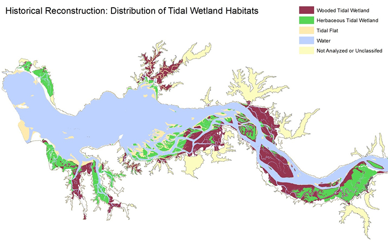
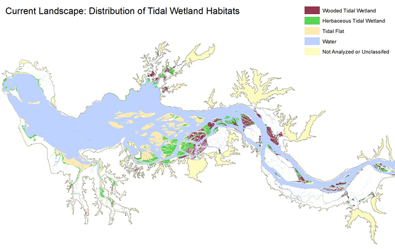
To measure how wetland habitats have changed from the time before modern human impacts to the present day, the partnership used NOAA’s C-CAP data to develop an up-to-date land cover map. The map was then compared to historical baseline data, which were developed using past coastal survey maps and General Land Office land survey data. These historical data sets covered the period from approximately 1870 to 1890, providing a substantial baseline for comparison with current conditions.
Impact
The results provided useful insight into the extent of change and significant declines in the vegetated tidal wetlands. Mapping helped determine that the cause for most habitat loss was conversion of land for agriculture and urban development. The partnership was able to identify various habitat types for recovery and protection for each portion of the river according to their relative extent of loss, as well as their value in supporting various species.


