Issue
In low-lying coastal areas, populations are rapidly growing and flooding rates are increasing. Many predictive models do not take the increasing population numbers into consideration, which means projected risk could be higher than what is reported.
Process
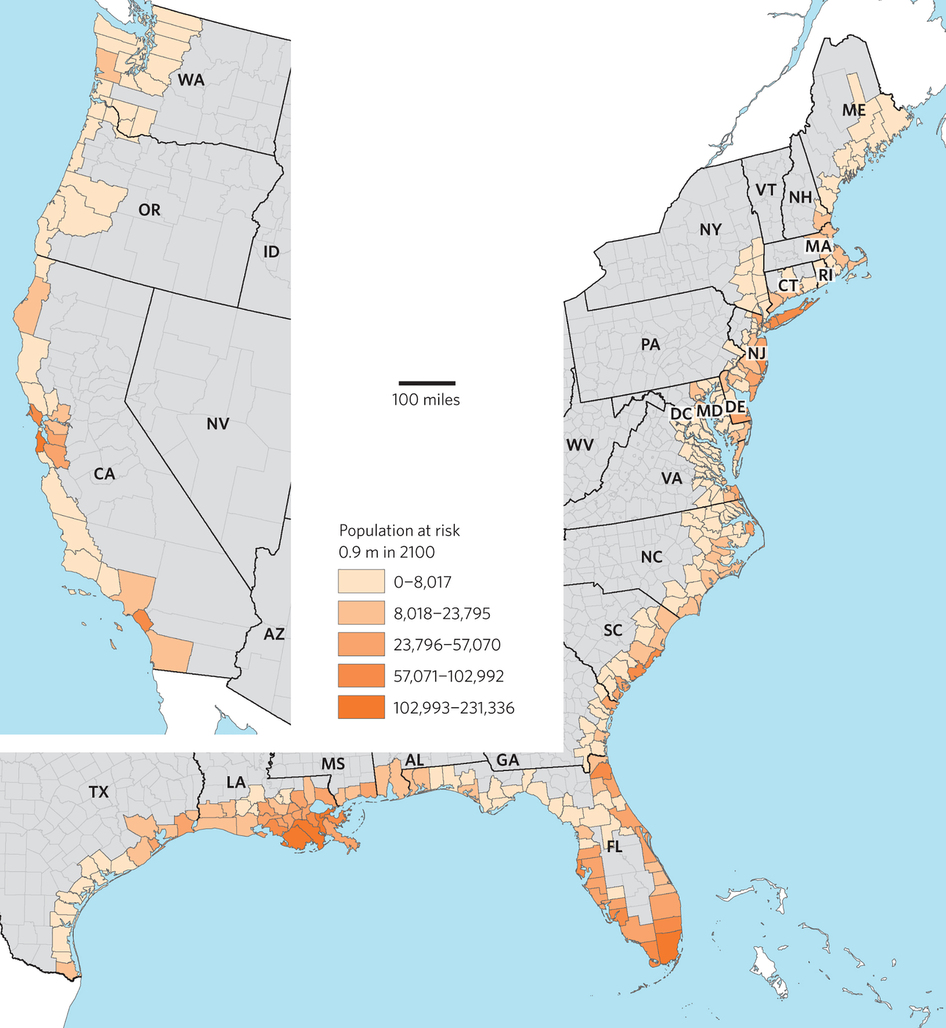
To assess the risk of future populations, the University of Georgia worked with Stetson University to model coastal inundation using two scenarios—three and six feet of sea level rise. The team overlaid NOAA’s sea level rise data onto maps showing future population projections to see which areas within the contiguous U.S. are most at risk.
Impact
The team estimates that by the year 2100
- Three feet of sea level rise will affect an additional 4.2 million people, with Florida accounting for nearly half of the total at-risk population. The following parishes or counties are each projected to see more than 100,000 residents impacted: California’s San Mateo County; Louisiana’s Orleans and Jefferson parishes; and Florida’s Broward, Pinellas, and Miami-Dade counties.
- A rise of six feet will affect 13.1 million people and include 25 counties more than the previous scenario. Florida’s Miami-Dade and Broward counties alone account for more than a quarter of this number. Areas with catastrophic impacts include Tyrrell and Hyde counties in North Carolina.
These valuable data are being used to inform climate adaptation plans throughout the coastal zone. (2016)

